
The People’s Republic of China (PRC) is home to the world’s ancient hydrological station, Baiheliang. It is located in the Fuling District of the Chongqing municipality of PCR. Ancient Chinese civilizations recorded water levels of the Yangtze River on the rock called Bailheliang, which means “White Crane Ridge”, in English. The rock was called “White Crane Ridge”, because of the white cranes that used to flock near it.
Since the first year of the Tang Dynasty in 763 BC, water levels of the Yangtze River were recorded with inscriptions of fish eyes and other hydrological annotations at Baiheliang. The rock served as a hydrometric station.
The rock laid submerged underwater for most of the year. In the winter and early spring seasons, the uppermost point of the rock would protrude from the Yangtze River’s surface. Then, the Chinese would indicate where the water level was according to what point of the rock it reached.
In total, there are 163 markings on Baiheliang, and 144 of those indicate the levels of the Yangtze River for over 1200 consecutive years. Along with water markings, there are inscriptions from over 300 ancients Chinese poets. This series of symbols and markings makes Baiheliang the longest sequences of its kind in the world.
Baiheliang was unknown to the Western world until the 1970’s, when Chinese experts brought photos of the site to a British international hydrological symposium. Hydrological experts analyzed the inscriptions of Baheiliang and concluded that there was a cyclic pattern of water levels of the Yangtze River.
According to experts, every three to five years there was a period of low water in the River. Every 10 to 12 years, there was a dry season, and every 600 years, there’s a season of very low water in the Yangtze River. Interestingly, China’s two largest water conservancy projects, the Gezhouba Hydropower Station and the Three Gorges Reservoir were both completed after consulting the systemic data provided by Baiheliang. Reliable data about the Yangtze River levels is found at Baiheliang as hydrological experts corroborated findings of the Baiheliang inscriptions.
In May of 2009, an underwater museum in the Fuling District of the PRC was opened and Baiheliang is now on display. The Baiheliang Museum welcomes visitors from all over the world. Building the Baiheliang museum costs $186 yuan, roughly $27.6 USD. The Museum was under construction for six years and finally opened its door on May 18, 2009.
The Baiheliang Museum is mentioned as one of the eight submerged museums listed by the United Nations Educational, Scientific and Cultural Organization (UNESCO). At Baiheliang, water science and culture truly intersect and a fascinating piece of history is left for present and future generations to explore.
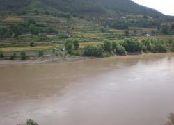
The photo above is a picture of the Yangtze River.
If you enjoyed this article, you should also read:
Indigenous Legends of Waterfalls in Latin America
UNESCO Works to Preserve Nautical Archaeology
Nautical Archaeology Threatened by Trawlers

Your Comments
4 Comments so far